
Trusted Trail Maps is an offline navigation app focused on exploring Utah. Download GeoPDF maps before heading out, then view them without cell service while the app shows a live GPS position, heading, and route. Maps and trail details cover activities such as hiking, mountain and gravel biking, OHV riding, overlanding, scenic driving, snowmobiling, and horseback riding. The developer says local tourism boards and trail organizations contribute trail information, including difficulty ratings, width limits, and condition reports. Public-land maps from the U.S. Forest Service, Bureau of Land Management, and National Park Service are also available. Users can submit trail-condition updates with photos and GPS location. Coverage is Utah-specific, and field conditions can change; confirm closures, access rules, and weather with local authorities before a trip. Current pricing is not stated in the listing.

Trusted Trail Maps
Trusted Trail Maps provides downloadable GeoPDF maps and live GPS tracking for trails and public lands across Utah. It includes local trail details, difficulty and width limits, condition reports, and maps from U.S. public agencies. Users can explore offline for hiking, biking, OHV, overlanding, scenic drives, and other outdoor activities; pricing is not stated.
Overview
A closer look at Trusted Trail Maps.
A closer look
App screenshots
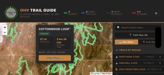
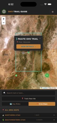
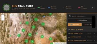
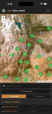
Choose with confidence
The useful details.
What it does
- Downloadable GeoPDF maps for offline viewing
- Live GPS position, heading, and route tracking
- Utah trail difficulty, width limits, and condition reports
- Public-land maps and trail filters by region or activity
A good fit for
- People exploring Utah trails and public lands
- Hikers, riders, and drivers who need maps outside cell coverage
Worth knowing
- Coverage is focused on Utah; conditions and access rules can change, so check official local guidance.
Frequently asked questions
Answers based on the app’s official listing and reviewed information.
What is Trusted Trail Maps used for?
Trusted Trail Maps provides downloadable GeoPDF maps and live GPS tracking for trails and public lands across Utah. It includes local trail details, difficulty and width limits, condition reports, and maps from U.S. public agencies. Users can explore offline for hiking, biking, OHV, overlanding, scenic drives, and other outdoor activities; pricing is not stated.
What can you do with Trusted Trail Maps?
Downloadable GeoPDF maps for offline viewing Live GPS position, heading, and route tracking Utah trail difficulty, width limits, and condition reports Public-land maps and trail filters by region or activity
Who is Trusted Trail Maps designed for?
People exploring Utah trails and public lands Hikers, riders, and drivers who need maps outside cell coverage
What should you know before downloading Trusted Trail Maps?
Coverage is focused on Utah; conditions and access rules can change, so check official local guidance.
Does Trusted Trail Maps include paid features?
The reviewed listing does not confirm current in-app purchase options.
Which platforms support Trusted Trail Maps?
Greatooly's reviewed app information lists iOS.
Researched from official sources; this is not a hands-on review. Last checked 2026-11-04.
Keep exploring
More apps that might be a good fit.

Tripdrobe: Outfit Packing List
Plan outfits and packing lists by trip date, with premium weather, baggage, wardrobe, and group tools.

SkyFlight Tracker
A flight companion with live status, gate countdowns, route maps, layover risk alerts, airport weather, and travel statistics.

FLITx・Live Flight Tracker Map
A live flight map for searching aircraft and routes, checking flight status, and viewing nearby airport activity.