
Traily combines topographic maps with current conditions for hiking, biking, running, and walking routes. Its Conditions Score uses weather information for a trail's location, including temperature, rain, snow, wind, and alerts, weighted by route length and difficulty. Users can record a session with GPS, distance, elevation gain, moving time, and pace, then attach short condition reports such as mud, snow, or high water to the trail. Core maps, scores, reports, and session recording are listed as free. Traily Pro adds downloadable offline map areas, unlimited saved trails and sessions, and more condition alerts. The US listing gives Pro pricing of $3.99 monthly or $24.99 yearly. Weather and trail information can change quickly; check official alerts, local access, and conditions before leaving.

Traily: Trail Maps & GPS
A trail map and activity tracker with daily weather scores, GPS route recording, trail reports, and optional offline maps.
Overview
A closer look at Traily: Trail Maps & GPS.
A closer look
App screenshots
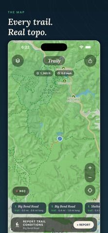
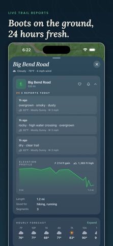
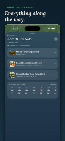
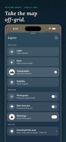
Choose with confidence
The useful details.
What it does
- View topographic trails with terrain shading and elevation profiles
- Review a trail conditions score based on location-specific weather
- Record GPS sessions with distance, elevation gain, time, and pace
- Post short trail reports and unlock offline map areas with Pro
A good fit for
- Hikers, runners, and cyclists comparing current conditions at saved trails
- People who want activity records and community trail reports in one map app
Worth knowing
- Offline map areas and unlimited saved trails or sessions require Pro; weather and user reports can be incomplete or change before a trip.
Frequently asked questions
Answers based on the app’s official listing and reviewed information.
What is Traily: Trail Maps & GPS used for?
A trail map and activity tracker with daily weather scores, GPS route recording, trail reports, and optional offline maps.
What can you do with Traily: Trail Maps & GPS?
View topographic trails with terrain shading and elevation profiles Review a trail conditions score based on location-specific weather Record GPS sessions with distance, elevation gain, time, and pace Post short trail reports and unlock offline map areas with Pro
Who is Traily: Trail Maps & GPS designed for?
Hikers, runners, and cyclists comparing current conditions at saved trails People who want activity records and community trail reports in one map app
What should you know before downloading Traily: Trail Maps & GPS?
Offline map areas and unlimited saved trails or sessions require Pro; weather and user reports can be incomplete or change before a trip.
Does Traily: Trail Maps & GPS include paid features?
Maps, conditions scores, reports, session recording, and the logbook are listed as free. Traily Pro is listed at $3.99 per month or $24.99 per year in the US for offline maps and higher limits.
Which platforms support Traily: Trail Maps & GPS?
Greatooly's reviewed app information lists iOS.
Researched from official sources; this is not a hands-on review. Last checked 2026-11-04.
Keep exploring
More apps that might be a good fit.

Lactis: Private Baby Tracker
Lactis logs baby feeds, sleep, diapers, pumping, growth, medication and milk storage, with caregiver handoffs, iCloud sync, exports and optional Pro insights.

neso: Baby Tracker
neso combines baby-care logs, personalized nap predictions, caregiver sharing, milestones and educational guidance between pediatric visits.

Handsful: Multiples Tracker
Handsful tracks feeding, sleep, diapers and growth for twins, triplets and other multiples, with shared caregiver logs and optional AI summaries.