
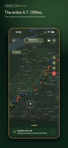
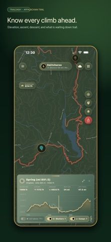
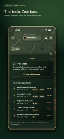
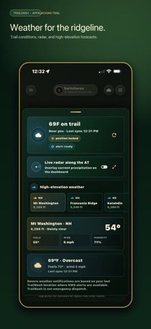
TrailDash is built for hikers traveling the Appalachian Trail where cellular service may be unavailable. Its offline map covers the full route across 14 states and identifies shelters, campsites, water sources, peaks, and trail towns. A GPS recorder tracks distance, pace, elevation gain, and time, and the app can show a trail elevation profile. Bluetooth mesh messaging can connect nearby hikers without cell service, with optional support for LoRa radio. Other tools include a digital shelter register, pack list, private trail groups, a journey link for family, severe-weather alerts, and an SOS screen with coordinates. TrailDash requires an active monthly or annual TrailDash Pass after account setup; current subscription prices are shown in the app. The developer explicitly warns that it does not replace emergency services or a satellite communicator. Hikers should carry a paper map, tell someone their route, and check closures and conditions with official trail sources before departure.

TrailDash: Appalachian Trail
An offline Appalachian Trail map and hiking companion with shelters, water sources, GPS logs, mesh messaging, and weather alerts.
Overview
A closer look at TrailDash: Appalachian Trail.
A closer look
App screenshots
Choose with confidence
The useful details.
What it does
- Use offline topographic maps and elevation profiles for the full Appalachian Trail.
- Find shelters, campsites, water sources, trail towns, and trail facilities.
- Record hikes with GPS, distance, pace, and elevation statistics.
- Message nearby hikers over Bluetooth mesh and share location with invited contacts.
A good fit for
- Appalachian Trail hikers who need offline maps and trail information outside cell coverage.
Worth knowing
- TrailDash Pass is required after account setup; subscription prices are shown in-app. It does not replace emergency services or a satellite communicator. Carry a paper map and verify current trail closures, weather, and water conditions.
Frequently asked questions
Answers based on the app’s official listing and reviewed information.
What is TrailDash: Appalachian Trail used for?
An offline Appalachian Trail map and hiking companion with shelters, water sources, GPS logs, mesh messaging, and weather alerts.
What can you do with TrailDash: Appalachian Trail?
Use offline topographic maps and elevation profiles for the full Appalachian Trail. Find shelters, campsites, water sources, trail towns, and trail facilities. Record hikes with GPS, distance, pace, and elevation statistics. Message nearby hikers over Bluetooth mesh and share location with invited contacts.
Who is TrailDash: Appalachian Trail designed for?
Appalachian Trail hikers who need offline maps and trail information outside cell coverage.
What should you know before downloading TrailDash: Appalachian Trail?
TrailDash Pass is required after account setup; subscription prices are shown in-app. It does not replace emergency services or a satellite communicator. Carry a paper map and verify current trail closures, weather, and water conditions.
Does TrailDash: Appalachian Trail include paid features?
TrailDash Pass is required for app use after account setup and is offered monthly or annually; current prices are shown in-app.
Which platforms support TrailDash: Appalachian Trail?
Greatooly's reviewed app information lists iOS.
Researched from official sources; this is not a hands-on review. Last checked 2026-11-04.
Keep exploring
More apps that might be a good fit.

Tripdrobe: Outfit Packing List
Plan outfits and packing lists by trip date, with premium weather, baggage, wardrobe, and group tools.

SkyFlight Tracker
A flight companion with live status, gate countdowns, route maps, layover risk alerts, airport weather, and travel statistics.
FLITx・Live Flight Tracker Map
A live flight map for searching aircraft and routes, checking flight status, and viewing nearby airport activity.