
Hiking Trail Directory & Maps helps hikers search and compare routes across 15 countries. The developer lists more than 15,800 trails, with strongest coverage in Switzerland and the United States. Search by park or destination, filter by difficulty, distance, elevation gain, and route type, then review available route details, photos, maps, and elevation profiles. Mapped routes can be exported as GPX files, and favorite summaries can be saved on the device. The app does not require an account, subscription, or in-app purchase according to its listing. Full maps, photos, and route details need an internet connection; saved summaries work offline, but the app does not provide offline navigation or live closure information. Trail coverage varies, so check access, weather, and local conditions before setting out.

Hiking Trail Directory & Maps
A hiking trail directory with 15,800 routes across 15 countries, interactive maps, elevation filters, and GPX export.
Overview
A closer look at Hiking Trail Directory & Maps.
A closer look
App screenshots
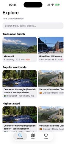
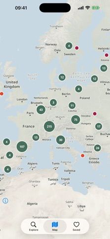

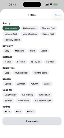
Choose with confidence
The useful details.
What it does
- Search a directory of hiking routes, parks, and destinations
- Filter trails by difficulty, distance, elevation gain, and route type
- View maps, route details, and available elevation profiles
- Export routes as GPX and save favorite summaries locally
A good fit for
- Hikers comparing route difficulty and elevation before choosing a trail
- Outdoor users looking for mapped routes across supported countries
Worth knowing
- Full route details require internet; saved summaries are not offline navigation, and live trail closures are not provided.
Frequently asked questions
Answers based on the app’s official listing and reviewed information.
What is Hiking Trail Directory & Maps used for?
A hiking trail directory with 15,800 routes across 15 countries, interactive maps, elevation filters, and GPX export.
What can you do with Hiking Trail Directory & Maps?
Search a directory of hiking routes, parks, and destinations Filter trails by difficulty, distance, elevation gain, and route type View maps, route details, and available elevation profiles Export routes as GPX and save favorite summaries locally
Who is Hiking Trail Directory & Maps designed for?
Hikers comparing route difficulty and elevation before choosing a trail Outdoor users looking for mapped routes across supported countries
What should you know before downloading Hiking Trail Directory & Maps?
Full route details require internet; saved summaries are not offline navigation, and live trail closures are not provided.
Does Hiking Trail Directory & Maps include paid features?
The reviewed listing reports no in-app purchases.
Which platforms support Hiking Trail Directory & Maps?
Greatooly's reviewed app information lists iOS.
Researched from official sources; this is not a hands-on review. Last checked 2026-11-04.
Keep exploring
More apps that might be a good fit.

Lactis: Private Baby Tracker
Lactis logs baby feeds, sleep, diapers, pumping, growth, medication and milk storage, with caregiver handoffs, iCloud sync, exports and optional Pro insights.

neso: Baby Tracker
neso combines baby-care logs, personalized nap predictions, caregiver sharing, milestones and educational guidance between pediatric visits.

Handsful: Multiples Tracker
Handsful tracks feeding, sleep, diapers and growth for twins, triplets and other multiples, with shared caregiver logs and optional AI summaries.